Photographer Discovers Ancient Inca Road in Ecuador's Llanganates That May Lead to Atahualpa's Lost Treasure
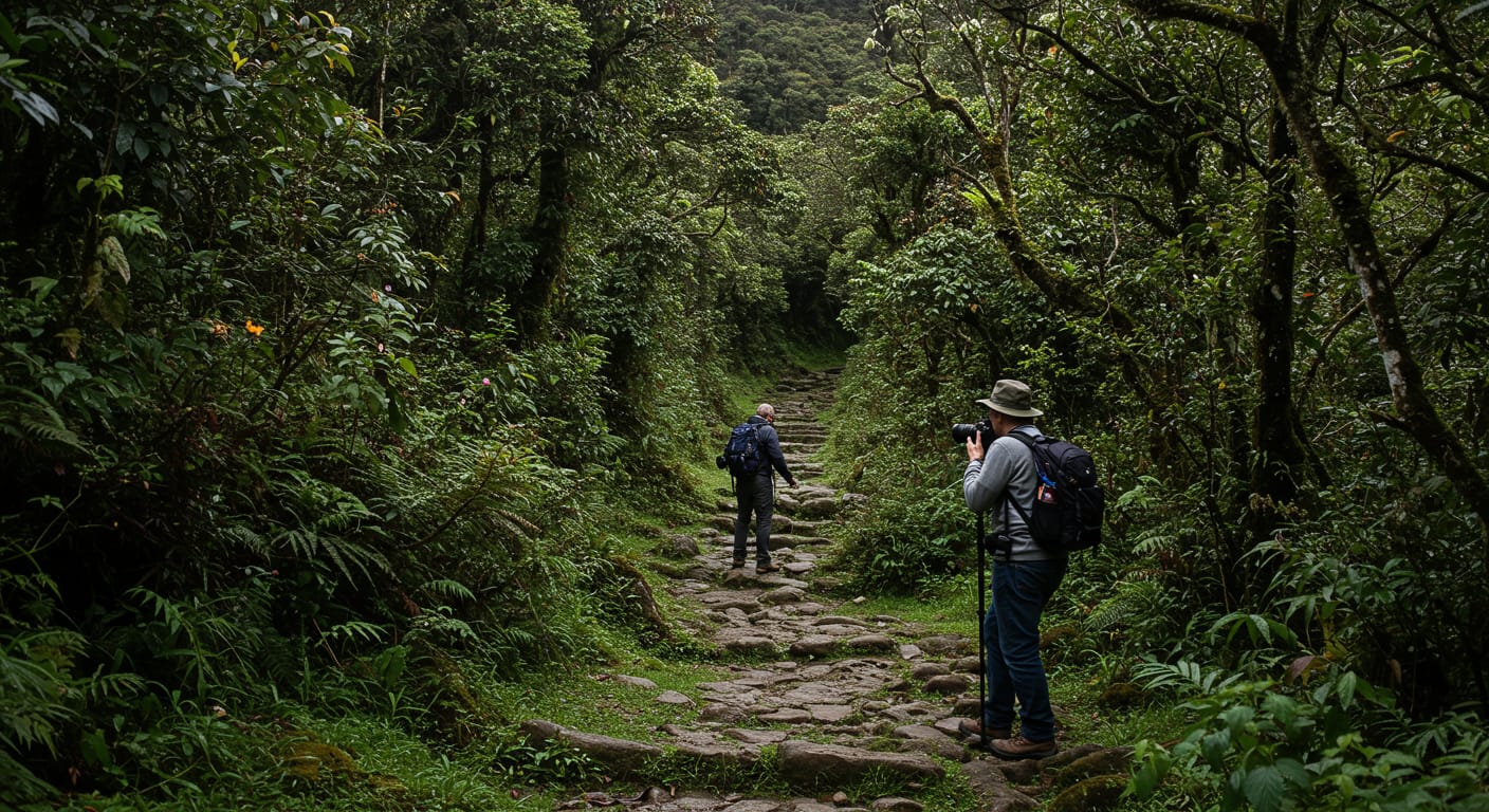
Deep in Ecuador's forbidding Llanganates mountain range, where mist-shrouded peaks have claimed the lives of countless treasure hunters, a photographer has made a discovery that could rewrite one of South America's greatest mysteries. What began as a routine expedition to capture the raw beauty of these remote highlands has yielded evidence of an ancient Inca road—one that appears to align perfectly with historical treasure maps pointing to the location of Emperor Atahualpa's legendary lost gold.
The Discovery That Could Rewrite History
The photographer, whose identity remains protected due to the sensitive nature of the find, was exploring a particularly remote section of the Llanganates when they stumbled upon unmistakable signs of ancient stonework. Unlike the rough trails carved by modern treasure hunters, this pathway displayed the characteristic precision of Inca engineering—fitted stones, strategic drainage, and sophisticated construction techniques that once enabled the Inca road network to span thousands of miles across the Andes.
What makes this discovery truly extraordinary is its location. When plotted against existing historical maps and documents related to Atahualpa's treasure, the road appears to follow routes that treasure hunters have theorized about for nearly five centuries. The alignment suggests this wasn't simply a local pathway, but potentially part of a strategic route used during one of the most desperate missions in Inca history.
The Legend of Atahualpa's Lost Gold
To understand the significance of this discovery, you have to go back to 1533, when the Inca Empire faced its darkest hour. Emperor Atahualpa, the last independent ruler of the Inca, had been captured by Spanish conquistador Francisco Pizarro in what is now northern Peru. The ransom demanded was staggering: a room filled with gold and two rooms filled with silver in exchange for the emperor's freedom.
As news of the capture spread throughout the vast Inca Empire, gold began flowing toward the Spanish stronghold. Llama trains loaded with precious artifacts, ceremonial objects, and raw gold made their way along ancient roads. But when word reached the caravan commanders that Pizarro had executed Atahualpa despite receiving much of the ransom, everything changed.
General Rumiñahui, one of Atahualpa's most trusted military leaders, made a fateful decision. Rather than allow the remaining treasure—estimated to be worth hundreds of millions in today's currency—to fall into Spanish hands, he ordered it hidden in the most inaccessible terrain the Andes had to offer: the Llanganates.
The Llanganates mountain range, straddling the border between the Andes and the Amazon basin, was the perfect hiding place. Its combination of extreme altitude, unpredictable weather, dense cloud forest, and treacherous terrain made it nearly impossible for Spanish forces to follow. But it also meant that recovering the treasure would be an almost superhuman challenge.
Reading the Ancient Road
The newly discovered road section shows several telltale signs that archaeologists associate with Inca infrastructure from the imperial period. The stonework displays the precise fitting techniques that allowed Inca roads to survive earthquakes and centuries of weather. Drainage channels carved alongside the pathway demonstrate the engineering sophistication that enabled these roads to function during the intense rainy seasons that characterize the Llanganates.
Perhaps most intriguingly, the road's direction and gradient suggest it was designed to move heavy loads efficiently through challenging terrain. This matches historical accounts describing how Inca engineers specifically modified certain routes to accommodate the massive treasure caravans that would have been necessary to transport Atahualpa's hoard.
When mapped using modern GPS technology and compared against historical documents, the road appears to connect with other known Inca route fragments in the region. This creates a picture of a comprehensive transportation network that could have enabled Rumiñahui's forces to move the treasure deep into the Llanganates while maintaining some possibility of future recovery.
Ecuador's Most Dangerous Treasure Hunt
The Llanganates mountain range has earned its reputation as one of the world's most dangerous treasure hunting destinations. Rising from 1,500 meters to over 4,500 meters above sea level, the range encompasses everything from Amazon rainforest to alpine tundra. Weather conditions can change from tropical heat to near-freezing temperatures within hours, and the region receives some of the highest rainfall in Ecuador.
The terrain itself presents constant hazards: unstable volcanic soil, hidden crevasses, rivers that can rise to flood stage within minutes, and dense vegetation that can completely disorient even experienced mountaineers. GPS devices frequently fail due to the thick cloud cover that gives the range its name—Llanganates means "beautiful liar" in Quechua, referring to the way the mountains' beauty conceals their deadly nature.
Over the centuries, the Llanganates have claimed numerous lives. Treasure hunting expeditions have disappeared entirely, leaving behind only scattered equipment and maps marked with increasingly desperate annotations. Modern technology has helped reduce some risks, but the fundamental challenges remain: this is terrain that actively resists human intrusion.
From Photography to Archaeology
The photographer responsible for this discovery brings a unique perspective to what has traditionally been the domain of professional treasure hunters and archaeologists. Their background in documenting remote landscapes provided the technical skills necessary to recognize and properly photograph the ancient stonework, while their experience with GPS mapping enabled precise documentation of the road's location and orientation.
Rather than rushing to publicize the find or attempt unauthorized excavation, the photographer has followed proper protocols for reporting potential archaeological discoveries. This approach reflects a growing understanding that modern treasure hunting requires collaboration with academic and government institutions rather than the secretive, independent expeditions that characterized earlier eras.
The documentation process has involved creating detailed photographic records of the stonework, mapping the road's route using GPS coordinates, and collecting soil and vegetation samples that could help establish the age and construction timeline of the pathway. This evidence will be crucial for professional archaeologists who may eventually conduct formal excavations in the area.
Next steps will likely involve verification by Ecuador's National Institute of Cultural Heritage and potentially by international Inca civilization experts. If the road's authenticity and age are confirmed, it could trigger more extensive archaeological surveys of the surrounding area—surveys that might finally provide definitive evidence about whether Atahualpa's treasure actually lies hidden somewhere in the Llanganates.
Whether this ancient road ultimately leads to the discovery of Atahualpa's lost treasure remains to be seen. But it has already provided valuable new evidence about Inca engineering capabilities and strategic planning during the empire's final years. For treasure hunters, archaeologists, and anyone fascinated by the mysteries of pre-Columbian America, this discovery represents a tantalizing step forward in one of history's most enduring quests.